Chris Kirkham
PLAQUEMINES PARISH, La. -- For decades, a mixture of industrial development and erosion has carved away at southern Louisiana, eliminating nearly 2,000 square miles of land and making the area increasingly vulnerable to storms that sweep in from the Gulf of Mexico.
Every day the Mississippi River delivers the raw materials required to replenish this lost territory: mud and sand that drop at the mouth of the waterway and would amass there, were nature allowed to run its course.
But nature has proven no match for the century-long federal governance of the Mississippi as a vital marine highway: Five enormous ships operated by the federal government dredge the sediment collecting at the mouth of the river daily, then carry much of it into open waters offshore and dump it there, sending it into oblivion.
This year’s historic flooding along the Mississippi River resonated as a threat to low-lying communities, sending families scrambling to preserve homes and property. But it was also a missed opportunity on an epic scale, say conservationists: The heavy rains that swelled the Mississippi loaded it with a massive supply of natural building materials that could have buttressed the Gulf Coast land. Instead, levees built to tame the river directed this sediment down to the mouth, where the federal ships are hauling it away.
Mouse over to see before and after photos of the disappearance of Louisiana's coast
Photos courtesy of USGS National Wetlands Research Center
“It’s basically crazy to let that sediment flow out into the open Gulf of Mexico, when you could be using it to build more Louisiana,” says Chris Paola, a geology professor at the University of Minnesota who is part of a team of researchers studying the Mississippi River and the collapse of its delta. “Why would you throw away real estate? If that real estate were under a shopping mall in New Jersey, nobody would tolerate just seeing it wasted. But that’s what we’re doing here.”
These clashing notions about the appropriate response to the flood rest on the surface of a long-entrenched battle over the core identity of the Mississippi, as communities and industries with divergent interests make competing claims on the river’s natural bounty.
Since the late 1800s, the government has managed the Mississippi as a superhighway for marine commerce, building levees that have maintained the channel to transport goods worldwide while providing flood protection for those living along its banks. But this intervention has exacted a steep cost: The levees have prevented the river’s mud from spilling over the banks and building up land in southern Louisiana, as it did for eons before.
As a result, the Gulf of Mexico has been able to slowly conquer the once-vibrant wetlands and marshes of southern Louisiana, creeping steadily northward and eroding away at the natural land barriers that have protected populated cities such as New Orleans from hurricanes.
Oil companies and the government have also cut up the coastline with additional canals and navigation channels, which have acted as a conduit for marsh-killing salt water.
“The flooding of Hurricane Katrina was in no small measure a consequence of allowing that wetland system to deteriorate,” said Paul Kemp, a former coastal sciences professor at Louisiana State University who is now a vice president at the National Audubon Society. “This system is not about to collapse; it’s collapsing.”
Experts dismiss the idea that the management of the Mississippi is a zero-sum game; a choice between protecting shipping and rebuilding coastal lands. With proper planning, both goals can be pursued at once, they say. But in a perverse consequence of federal regulations, the U.S. Army Corps of Engineers is required to choose the cheapest way to dispose of the mud that now collects at the mouth of the river, which has meant dumping it offshore.
In so doing, the federal government is squandering the free materials offered by nature to protect coastal Louisiana and New Orleans from a steady descent into the sea.
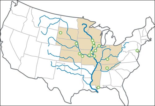
Carried from as far away as Montana, Minnesota and New York, sediment flowing down the Mississippi River has supplemented the land of what is now the southern United States for more than a million years.
Major floods have acted as crucial infusions of fresh material, sending mud and fresh water cascading over the river’s banks. But the re-engineering of the river over the last century has largely put a stop to that function.
The past decisions made perfect economic sense at the time: Ships needed easy passage to the nation’s interior; farmers wanted certainty that their crops would survive. But as the environmental costs have become clearer, conservation groups, scientists and government officials in Louisiana have pointed out the pitfalls of a management scheme that was conceived in a much different time.
The loss of the estuary environment, where fresh and salt water intermingle, threatens the long-term survival of one of the world’s most productive fisheries. Entire cities, major oil refineries and some of the busiest American ports now lack historical natural barriers from hurricanes.
Satellite images show a division of two worlds: the untapped natural resource of the river and its mud pulsing directly through the disappearing region of wetlands and pouring into the Gulf of Mexico.
For years, state and local leaders and national environmental groups have pushed for a different approach to managing the river’s valuable sediment -- embracing the power of natural forces instead of fighting them. The goal is to mimic past major flooding events by allowing sediment and fresh water to be strategically redirected into the adjacent marshes farther upstream through engineered breaks in the levees, or through pipelines that would funnel mud from the river into wetlands.
Dozens of Mississippi River delta restoration projects have been drawn up over the years by various federal agencies, but so far they are mostly theoretical designs sitting on shelves as the state has struggled to secure federal funding.
The costs have been a major sticking point. The price tag for one of the largest proposed sediment diversion projects, on the west bank of the Mississippi River, is upwards of half a billion dollars. And design problems with past projects have illustrated the engineering challenges entailed in meddling with nature.
But the costs of doing nothing different and continually plow piles of mud at the mouth of the river are expected to escalate as well. During the past five years, the Army Corps of Engineers has spent more than $100 million each year to keep the lower river open by dredging. The belief is that by eventually redirecting sediment from the river to adjacent marsh environments, the government could avoid some the mounting expenses of clearing the mouth of the river while also preserving crucial land barriers.
Conservationists assert that the status quo only seems like the lowest priced option because of the nature of the accounting: The federal government is not counting the costs absorbed by coastal communities who must live with greater vulnerability to hurricanes. The calculation does not reflect the impact to valuable fisheries -- and the people who rely on them for their livelihoods.
“This is a very rich place that we’ve been harvesting and harvesting for decades,” said Foster Creppel, who runs the Woodland Plantation, a historic inn and eco-tourism destination in Plaquemines. “People think it’ll never go away, that it’ll keep giving. But it won’t. We’re going to take from it until we kill it.”
MASSIVE WETLANDS
The southern stretches of the Mississippi River in Louisiana are a remote and wild region of marshlands, bays and lakes that stretch more than 100 miles south of New Orleans before giving way to the Gulf of Mexico.
It’s a vast landscape that totals a third of all coastal wetlands in the United States. It’s home to a quarter of the seafood catch in the lower 48 states and is the winter habitat for 70 percent of migratory birds that fly across the central United States.
It is also a major industrial hub: 20 percent of the nation’s waterborne commerce is handled at Louisiana ports along the Mississippi River; the state has 20 percent of the nation’s petroleum refining capacity; and including offshore wells, it is the number one producer of oil in the country.
The problem is that these two basic functions –- commercial center and ecological wonderland –- have been in direct conflict for decades when it came to the question of dealing with the river. In large part, the national commercial interests of navigation and oil have trumped concerns about effects on the surrounding environment, leaving a system that funneled sediment all the way to the Gulf.
The abundant mix of natural resources along the lower Mississippi River -- and the human desire to extract them -- prompted a massive human intervention aimed at harnessing the river’s power.
Floods destroyed farmlands and homes. So settlers looked to prevent them, building dikes and levees to protect investments from being inundated.
Mouse over to see additional land loss in Louisiana
“The water resources management of the United States was built to maximize flood storage, to maximize hydropower, and to quicken the exit of floods as fast as they could,” said Phil Turnipseed, director of the U.S. Geological Survey’s National Wetlands Research Center. “We built our infrastructure for that. But in the last 30 years, we’ve got a new science that has come along that is really telling us that ecosystems are incredibly valuable to the continent and the population in so many different ways.”
A century ago, the landscape of coastal Louisiana was much different than today. A casual look at the names of geographical features and towns hints at what has been lost over time. An enormous open bay is still called “Little Lake”; “Golden Meadow,” now a coastal town almost completely surrounded by water, once boasted vast fields of crops and flowers.
But even dating back to the turn of the 20th century, when there was a much more robust coastal environment, observers who followed the construction of levees along the lower Mississippi River were already aware of the consequences for the environment.
A December 1897 edition of National Geographic noted the “great benefit to the following two and three generations” from building levees for flood control along the river, but also predicted “disadvantages to future generations” from the eventual disappearance of land.
Louisiana and the nation have certainly reaped the rewards of those past decisions, with major port complexes and oil and gas infrastructure taking root in the natural marsh system, bringing jobs and modern highways to a place that was at one time a wilderness. But disconnecting the river has ultimately led to the area’s ecological demise.
“Yes, the last three generations did benefit,” said Robert Twilley, a longtime coastal scientist who is Vice President of Research at the University of Louisiana-Lafayette. “But for this fourth generation that is making the decisions right now, they’re the ones who are going to have to deal with this in 2050. And the consequences are much more than what we anticipated 100 years ago.”
ENGINEERING THE RIVER
During this year’s flooding, the Corps of Engineers is facing a major budget shortfall in its effort to keep the river open to navigation. In past years, the agency has shifted money from other projects around the country into its program for dredging the river between Baton Rouge and the Gulf of Mexico, for an average of $109 million each year over the past five years.
This year, the Corps doesn’t have the flexibility it has in past years to move money, so the agency will have to live with only $73 million to maintain a dredging program when there is a high discharge of mud in the river. The shortfall has prompted a flurry of activity among commercial interests on the lower river.
Shipping and port officials have major concerns that the river may not be passable for the largest, deep-draft ships this year, and are calling for Congress to include additional emergency appropriations of nearly $100 million to boost the Corps of Engineers’ dredging budget.
Those dredging costs are expected to continually increase, many coastal scientists and geologists argue, especially as the current mouth of the river continues to sink into the Gulf, making the channel less defined. This has prompted many to raise questions about why so little has been done to benefit a disappearing environment while also benefiting navigation into the future.
“The approach nowadays is ‘When it breaks, we’ll fix it,’” said Kemp, the coastal scientist at the Audubon Society. “And of course it costs five times more that way.”
Gary LaGrange, the president and chief executive of the Port of New Orleans, understands the importance of both maintaining a navigation channel and restoring natural storm buffers to protect New Orleans – and the largest combined port system in the United States.
He agrees that diverting sediment before it piles up at the mouth of the river would be of benefit to all. But he said it would take foresight and a willingness to pay now for future benefits.
“It’s like a plug in a bathtub, where everything goes to the plug at one time,” LaGrange said. “If you could alleviate what goes to that plug a lot sooner, then that would probably reduce a lot of your costs and a lot of your efforts.”
But just as engineering the river 100 years ago for flood protection required enormous sums of money for levee systems, re-engineering it to benefit the environment is also a massive undertaking.
In total, cost estimates for restoring Louisiana’s coastal landscape range upwards of $100 billion -- the largest environmental engineering project in the nation’s history.
So far the biggest challenge has been finding vehicles to pay for such projects. After Hurricane Katrina, Congress passed a water resources bill that included authorizations for several river diversion projects below New Orleans. Several years ago the cost was estimated above $1 billion for three diversions, but so far Congress has not appropriated money toward construction costs.
In five years, Louisiana will begin receiving a share of offshore oil royalties that it has sought to capture for decades. The estimated $200 million-per-year will go exclusively toward coastal restoration and storm protection.
Despite the anticipated money, scientists and policy makers in Louisiana say that much more is needed -- and that time is running out.
“We’ve got these things kicking around in the background, but unfortunately I think it’s going to be a long time before we see any of them function,” said Joseph Suhayda, a retired coastal engineering and oceanography professor at Louisiana State University. “And as we’re talking, the sediment’s passing by.”
Two of the major diversions of the river that have been built so far -- one above New Orleans on the river’s west bank and one below New Orleans on the east bank -- have faced criticism over the past two decades because of perceived design flaws. Those river diversion structures have mostly moved fresh water from the river, not sediment, causing strife with the oyster industry and other fishermen who have seen their catch affected by the changing saltiness in the environment.
Fresh water is an important component in restoring marsh habitats. Encroaching salt water from the Gulf of Mexico has acted like a slow-moving poison, eating away and eventually killing marsh grasses and coastal forests that can’t survive in salt water. So freshening the system using the river will create better conditions for marsh growth.
But building land requires mud, which comes down the river with its greatest capacity during floods such as the one this year. Many coastal scientists believe that engineered structures to divert river mud into Louisiana marshes should only be operated during flood stages, when river mud is the most churned up and flowing at the highest volumes.
Theoretically, those who do business on the river and on the coast wholeheartedly support getting river mud out into the marshes. But the past experience with poorly designed projects has left many suspicious about how such projects can be built and sustained over time.
“Does it seem like there should be a way to design a diversion so that it works? Sure,” said Sean Duffy, a maritime advocate with the Mississippi River Maritime Association, a trade group representing shipping interests on the lower river. “But my message to the coastal guys is that the next one needs to work. We can’t be coming back here saying, ‘we learned some lessons but it’s never going to lead to the accumulation of land that we hoped for.' "
TIME RUNNING OUT
Driving south of New Orleans on the four-lane Louisiana 23 has the feeling of traveling to the end of the earth. It’s the only highway through this southernmost stretch of the Mississippi River, a narrow ribbon of land between the river and the marshes called Plaquemines Parish.
Plaquemines is basically a series of rural towns and fishing villages stretching below New Orleans along the river until the highway ends and the Gulf begins. There’s not a single stoplight for 70 miles.
You might call it “a land between two levees.” Look left, and you’ll see the massive levee holding back the Mississippi River. Look right, and there’s another levee to prevent the few homes and farms from being flooded by the wetlands that are increasingly giving way to the ocean.
This remote stretch of the river holds the key to comprehensive restoration. It’s where natural floods of the past would have carried mud for miles, building forested ridges and swamps whose roots held the system intact.
The river built this land, which came to be cultivated into vast fields for agriculture.
Families from as far afield as the Canary Islands and Croatia raised vast groves of oranges and satsumas and plied the marshes for oysters, crabs and shrimp. Yet over the past few decades, land loss has taken a toll on these communities.
Hurricane Katrina was the reckoning, where communities along this stretch of the river felt the full force of the disappearance of hundreds of square miles of protective land. Only about a third of the population has returned.
Those who have feel a keen sense of their relationship with nature -- and of the missed opportunity of this year’s flooding.
“They flooded places all over the country this year, yet in the one area where it’s supposed to flood -- Plaquemines Parish -- we’re not allowing it to flood at all,” said Creppel, who runs the Woodland Plantation inn in Plaquemines. “What we should have done to begin with is build our levees a little lower, our houses a little higher, and have engineered areas where we let the river move and flow.”
Just down the highway from Creppel’s inn is a stand of skeletal oak trees withering away due to the intrusion of salt water from the sea. It’s a stark reminder of the relentless power of the Gulf of Mexico.
Salt water eats away at this stand of oak trees, leaving behind only skeletons
Those who work around the marshes every day feel an uneasy dread about what is to come in the next few decades. Roland Hingle, a lifelong shrimper who lives in a tiny outpost community in Plaquemines called Port Sulphur, points to the navigation system on his boat, which still shows green land over an open lake that is at least eight feet deep.
Such systems are rendered nearly useless in the constantly deteriorating landscape of the coast. “This should have been done 50 years ago,” he reflected as he piloted his boat around some of the few remaining tufts of marsh grass in the area. “Back then it was millions; now it’s billions.”
Fishermen in this area have less trouble going after the shrimp and crabs they seek than in the past. The lack of marshes has given way to open waters, allowing larger boats that once could only operate in the Gulf to move farther inland.
But as the marsh disappears, so does the prime habitat for a vast majority of the marine life in the Gulf of Mexico. It is in Louisiana’s wetlands that popular species such as red snapper and Bluefin tuna grow to maturity.
“Everything is from the estuary,” said Eric Hansen, a seafood dealer in Port Sulphur who buys shrimp and sells it wholesale across the Gulf. “A lot of offshore species begin their life in the marsh system, and if coastal erosion is not taken care of, were going to have a collapse of the industry. I don’t think too many realize that.”
Farther down Louisiana 23 in Buras, where Hurricane Katrina made its first landfall in 2005, Joey Ordoyne was preparing for a two-day shrimping voyage, rigging up nets and repairing winches. “That is the Gulf, literally,” he said pointing out to the marshes that were just at the edge of his boar harbor.
He laughed with the wry sense of humor that many along the Louisiana coast have these days when he turned to point to the Mississippi River levee, where mud was cascading by less than a mile away.
“It all goes back to Old Man River,” Ordoyne said. “This place wouldn’t be here without the river. These people wouldn’t be here without the river. These shrimp wouldn’t be here without the river.
“Let Old Man River alone.”
Thursday, June 09, 2011
In Historic Flooding On Mississippi River, A Missed Opportunity To Rebuild Louisiana
Subscribe to:
Posts (Atom)
