Tuesday, September 30, 2008
NYC notes - use on Th open notes quiz / followed by notes on Los Angeles & on Chicago

1. UN headquarters. b
2. Queens. b
3. The most densely populated major city in the United States. b
4. Nineteen point 7 million people. b
5. Nearly 170 languages were spoken in the city and 36% of its population was born outside the United States. b
6. “The city that never sleeps.” b
7. “Gotham.” b
8. The Big Apple. b
9. The capital of the US from 1785 until 1790. b
10. The Harlem Renaissance in literature and visual art. b
11. Abstract expressionism in painting. b
12. Tin Pan Alley music. b
13. Broadway theater. b
14. New Amsterdam. b
15. Algonquian tribe. b
16. The Mohican tribe. b
17. John Peter Zenger and Freedom of the Press. b
18. Columbia University. b
19. US Bill of Rights. b
20. Erie Canal, 1825. b
21. Draft Riots of 1863. b
22. Subway system, 1904. b
23. Built upon 3 islands. b
24. Battery Park. b
25. Long Island Sound. b
26. Humid subtropical climate. b
27. Chrysler Building. b
28. Brownstone rowhouses. b
29. Prospect Park and Central Park. b
30. The birthplace of rap and hip hop culture. b
31. Coney Island. b
32. Greenwich Village. b
33. Madison Square Garden arena. b
34. Shea Stadium. b
35. The Mets. b
36. JFK International Airport. b
37. Ellis Island. b
38. LaGuardia Airport. b
39. The second largest center for the film industry in the US. b
40. Carnegie Hall. b
41. Metropolitan Museum of Art. b
42. Times Square. b
43. Lincoln Center for the Performing Arts. b
44. Juilliard School of Music. b
45. Bagels. b
46. Cheesecake. b
47. Time Warner communications. b
48. Wall St Journal. b
49. ABC, NBC, CBS, Fox. b
50. Yankees and Mets. b
51. The Rangers. b
52. The Knicks. b
53. Park Avenue. b
54. Rockefeller Center. b
55. Tribeca neighborhood. b
56. Home to the largest Jewish community outside Israel. b
57. The largest African American community of any city in the United States. b
58. The Puerto Rican population is the largest outside of Puerto Rico. b
59. The George Washington Bridge is considered one of the world's busiest bridges in terms of vehicle traffic. b
60. The city consists of five distinct boroughs. b
Los Angeles notes
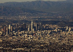
1. Largest city in the most populous state. a
2. City with Hispanic background. a
3. City in 3rd largest state by area. a
4. The mid-1800’s saw a gold rush near here. a
5. City in most populous state. a
6. Aerospace businesses are a major part of the economy. a
7. Petroleum is a major factor here. a
8. Second largest US city. a
9. Population of about 4 million. a
10. City spread over a 500 square mile area. a
11. Metro population of about 13 million. a
12. Sited in the most populous county in the US. a
13. El Pueblo de Nuestra Señora la Reina . . . a
14. Motion picture industry. a
15. Chumash tribal peoples are indigenous. a
16. Juan Rogriguez Cabrillo was a founder. a
17. Portola and Crespi are European developers. a
18. Mulholland’s aqueduct was essential. a
19. Earthquakes! a
20. The only major city that is bisected by a mountain range. a
21. Central river lined in concrete. a
22. Affected, from time to time, by tsunamis. a
23. Mediterranean climate type. a
24. Sage scrub botanical environment, featuring much chapparal. a
25. Built in a basin. a
26. Prone to atmospheric inversions. a
27. Neighborhood known as South Central. a
28. San Fernando Valley. a
29. Venice Beach. a
30. Bel Air neighborhood. a
31. Brentwood neighborhood. a
32. Walt Disney Concert Hall. a
33. The Watts Towers a landmark. a
34. 46% of population is Hispanic. a
35. Largest manufacturing city in US. a
36. USC, the University of Southern California. a
37. Twentieth Century Fox company. a
38. Sunkist. a
39. Warner Brothers, Burbank. a
40. Mattell Toys, home of Barbie. a
41. Rodeo Drive. a
42. The largest Roman Catholic archdiocese in the country. a
43. Home to the greatest variety of Buddhists in the world.
a
44. Lakers. a
45. Dodgers. a
46. Clippers. a
47. UCLA. a
48. Host city for the World Cup, 1994. a
49. L.A.X. airport. a
50. Port of Long Beach. a
Chicago's Moving Bridges over the Chicago River
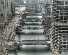
1. Largest city in the American Midwest. c
2. Called the US “Second city.” c
3. Metropolitan population of almost 10 million. c
4. Adjacent to Lake Michigan. c
5. AKA the “Windy City. “ c
6. Founded at the site of a portage between the Great lakes and the Mississippi River. c
7. O’Hare Airport, the nation’s second busiest. c
8. Al Capone & other gangsters ruled here in the 1920’s. c
9. Political home of Barack Obama. c
10. Name means “striped skunk,” or “wild onion.” c
11. First settler was Jean Baptiste Pointe du Sable. c
12. Founded in 1837, 2 years after Shreveport. c
13. Illinois and Michigan Canal opened in 1848. c
14. Great Fire of 1871 destroyed one third of the city. c
15. Became a center for jazz in 1920’s. c
16. Sears Tower, one of the world’s tallest buildings. c
17. Sited in Cook County. c
18. Humid continental climate type. c
19. City of the The Loop. c
20. Lincoln Park and Millenium Park. c
21. The reflective Cloud Gate sculpture known locally as "The Bean." c
22. The city has been rated as having the most balanced economy in the United States, due to its high level of diversification. c
23.The city is the birthplace of house music. c
24. Navy Pier houses retail, restaurants, museums, exhibition halls, and auditoriums. c
25. The ___-style hot dog, typically a Vienna Beef dog loaded with neon green pickle relish, yellow mustard, pickled sport peppers, tomato wedges, dill pickle spear and topped with celery salt. c
26. The Maxwell Street Polish, which is a kielbasa on a hot dog roll, topped with grilled onions, yellow mustard and the optional sport peppers. c
27. The Cubs. c
28. Wrigley Field. c
29. White Sox. c
30. The Bears. c
31. Soldier Field. c
32. The Bulls. c
33. The Blackhawks. c
34. The Fire, the Sting, the Power. c
35. The Oprah Winfrey Show. c
36. The Jerry Springer show. c
37, PRI's This American Life and NPR's Wait Wait... Don't Tell Me!. c
38. 37% African American population. c
39. Largest white ethnic group are those of German descent. c
40. The largest ethnically Polish population of any city outside of Poland (second only to Warsaw). c
41. The second largest African American population in US.
c
42. Northwestern University. c
43. The adjacent northern suburb of Evanston. c
44. Hillary Rodham Clinton c
45. Jesse Jackson c
46. Kanye West c
47. Frank Lloyd Wright, architect. c
48. Billy Corgan, Smashing Pumpkins. c
Canada and the connections with the US and Louisiana
Canada and the connections with the US and Louisiana
1. Russia and Alaska: what was the relationship? Russia owned Alaska. They sold it to the US in the mid-1800’s.
It was an example of the US at its best. Think big! Take risks!
2. In what region of Canada do we see the famous Louisiana connection? Eastern Canada: Quebec Province.
2. The French immigrants who would migrate to Louisiana lived on the edge of Canada for how many years?
a) 50 b) 150 c) 500. About 4 generations; some 150 years.
3. Which European group wanted to expel the French colonists? The British won Canadian properties in a war. They renamed the French land called Acadia. The British called it Nova Scotia, or “New Scotland.”
4. The French called the expulsion le grand derangement. That’s similar to which American words? “Deranged” means “Crazy” or “messed up.” The British expelled the French because they were so obnoxious and hard to govern.
5. Were the Frenchmen sent directly to Louisiana? No.
To what locations were they sent? a) the Caribbean islands b) The American colonies c) France.
6. What do we call the earliest French-speaking people to settle in Louisiana? Creole people. The word “creole” referred to the “cry” of a baby born in the New World.
7. Which French group was second to populate the state?
The Acadians, or Acadiennes. Their name was morphed to Cajuns.
8. Which European group was in control of La when the Acadians migrated to the Mississippi? The Spanish.
9. In what region of La did the Acadians settle? In the swampy region distant from New Orleans. They would be isolated for the next 100 years.
10. From which region of France did most of the Acadians originate? From Western France, where the impoverished French were routinely mistreated.
11. Who was the French-Canadian leader who cut a deal with the Spanish to get the Acadians taken to Louisiana? His name was Beausoleil.
12. Who were the 2 brothers from Montreal who won fame by exploring the Gulf coast and establishing the city of Nouvelle Orleans? Mssrs. Iberville and Bienville!
Another product of Canada: the gymnastic, dance & music extravaganza called Cirque de Soleil
Cirque du Soleil (French for "Circus of the Sun,") is an entertainment company. Based in Montréal, Québec, Canada and located in the inner-city area of Saint-Michel, it was founded in Baie-Saint-Paul in 1984 by two former street performers, Guy Laliberté and Daniel Gauthier.[1]
No ring and no animals helped make Cirque du Soleil the modern circus ("Cirque Nouveau"/New Circus) that it is today.[3]
Each show is a synthesis of circus styles from around the world, with its own central theme and storyline. They draw the audience into the performance through continuous live music, with performers rather than stagehands changing the props, and by having no curtains. After critical and financial successes (Los Angeles Arts Festival) and failures in the late 1980s, Nouvelle Expérience was created – with the direction of Franco Dragone – which not only made Cirque profitable by 1990, but allowed it to create new shows.[4]
Cirque expanded rapidly through the 1990s and 2000s, going from one show with 73 employees in 1984 to approximately 3,500 employees from over 40 countries producing 15 shows over every continent, with an estimated annual revenue exceeding US$600 million.[2][5] The multiple permanent Las Vegas shows alone play to more than 9,000 people a night—5% of the city's visitors—adding to the 70+ million people who have experienced Cirque.
Monday, September 29, 2008
Digital tablet a communications medium for the future
I love my Wacom Bamboo.
This week I've returned to using one of my favorite tools: the digital pen. I can sketch my instructions in color - on the computer screen - via the relatively inexpensive Wacom Bamboo.
Today's example of how to do the assignment on Fri - the US / Canada Interdependence graphic report - was shown to the class via the tool above. I paid $66 for mine via Amazon. com.
- Artists, I beg you to investigate.
- Graphic designer and photographers: it works really well with PhotoShop.
- People who have wrist and hand problems: it can replace the mouse.
Read more about this tool. You may find that it can be helpful for the entire family.
Bonus credit for a home subscription to the Shreveport Times
If you still "take" the Times, you are part of a shrinking group of citizens. In some of my classes 90% or more of my Magnet freshmen say their family does not subscribe to the Times.
Yet as a social studies teacher, college-readiness coach and writer, I know the importance of getting a physical paper in hand every day. I read both the newyorktimes.com and the shreveporttimes.com each day. When I have the paper copy in my hands I always get more value. With paper folded in front of me, I see more, I consume a bit more, I profit more.
So I offer this experiment as an optional but important consideration -
* Try a subscription to the Times for 3 months, $10 per month. Put an emphasis on skimming the paper virtually every day.
* Try to measure your value. I contend that it beats using KDAQ, KTBS, KEEL or any other source for regional news.
* The Times at its best is an important element of this community. Example? See the lengthy article on Sun on a waste disposal company that has repeatedly dumped toxic waste in the Red River.
Reasons not to take the Times are many.
- Cost. That's understandable, yet I consider it a smart investment, not a trimmable expense.
- Time. Some days there's no time to read the paper. I know! Yet I save the paper and catch up every few days. I still find reading a dated paper quite advantageous.
- Clutter. Yes. Well, it is intelligent clutter.
- Bias. All newspapers are imperfect and biased in various ways. The Times works hard to bring both liberal and conservative voices into print each day.
- Quality. The Times does not operate at what you might call an award-winning level. But it is a usable product produced by educated people who care about the quality of their work.
Newspapers perform an important role in the checks and balances of the US system. The 3-way struggle for dominance involves business, government and the press. Each entity would be happy if the other were not looking over its shoulder.
- Government tries to bring oversight to industry.
- Industry tries to influence the course of legislation and governmental activity.
- The press tries to keep both government and industry accountable to the public.
- Both the government and industry constantly try to muzzle the press. They both have many ways to be persuasive in regards what the press prints.
- The public rewards the press when it reveals the key secrets of industry and government.
- It's is similar to the legislative vs executive vs press part of the checks and balances system.
Sunday, September 28, 2008
Toronto, Canada's Michael Cera is huge, dude
Talking about the happening Canadian of the moment? Then it must be Michael Cera.
In a profile in the NY Times - in advance of his new movie, Nick & Norah's Infinite Playlist - we learn, "Mr. Cera grew up in Brampton, Ontario, a bedroom community outside Toronto. But unlike Nick and Norah, who feel the bright-lights pull of Manhattan from New Jersey, Mr. Cera never hoofed it to Toronto for the urban night life. In his young-curmudgeon way he recoiled at the suggestion: “I can’t stand bars. It’s too loud, and I get paranoid with a lot of people around. People are very obnoxious in bars. They try and take your picture. There’s no discretion.”
Both of Mr. Cera’s parents worked for Xerox when he was young. After thriving in a local improv class, he began auditioning for commercials and Canadian television while attending a big public high school. After moving to Los Angeles with his mother, he landed the part of the youngest member of the wealthy Bluth family on the absurdist Fox comedy “Arrested Development.”
“He has a sharp sense of subtlety,” said Jason Bateman, who played his father on that show. “He really trusts that the audience and the camera are watching. The only time I’ve seen directors giving him notes is when they ask him to do more, and it’s usually because that director has a more sophomoric sense of humor than he does.”
Btw, I thought Juno was terrifically entertaining and well written. But that movie doesn't flow with our unit, does it?
The week of Sept 29 - Oct 3 / Canada: why we know so little about our northern neighbors
Quiz on Thurs: a replay of last week's identifications on NYC, Los Angeles and Chicago. Open notes. About 20 questions.
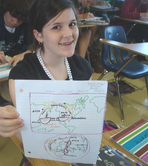
Map project due Fri (8 pts): the connections between Canada and America.
A one-page, illustrated (4) and colorful graphic message - based on a map of the 2 nations - of the interchange of ideas, goods and personalities between the 2 countries.
Examples:
- ideas (2): government-supported health care.
- goods (2): Canada is the single largest foreign supplier of energy to the U.S.-- providing 17% of U.S. oil imports and 18% of U.S. natural gas demand.
- people (3): Avril Lavigne, Jim Carrey.
- Titling, sources, major cities and bodies of water.
This week we enter a region entirely mysterious to Americans: Can ada.
Canadians are much more successful, cooler and worthy of our attention than we realize. Because of their controversial public health care system, wealth and successful investments, vibrant cities and cultural richness, we need to know Canada.
Nova Scotia -
We will begin the week with our personal connection to Canada: the Nova Scotians. How well did you learn your lessons on the Acadians when you were in Louisiana studies?
Can you create a story that illustrates the French migration to Canada and the British expulsion of the French from Nova Scotia? Can you briefly bring to life the brothers Iberville and Bienville?
Profiles of three great cities that Americans overlook will be developed in class this week:
Vancouver
Toronto
Montreal
Canadian music week - we will play examples of music by writers born in Canada.
Examples:
Joni Mitchell
Neil Young
Thursday, September 25, 2008
Los Angeles, Chicago, NYC: Urban Quiz Bowl guidelines below
The identifications/questions will be cut into individual strips so they can be drawn at random by a student and read to the contestants.
Divide the class into 5 teams of 5 or 6 or 7 by alpha roll.
Groups 1 and 2 face off and are read, alternately, 31 questions.
A student is chosen to pick the questions at random and hand them to Mrs Hanson to be read.
Alternate the reading: question 1 is read to group 1. Question 2 is read to group 2. Question 3 is read to group 1.
Each team may confer with the classmates in the group and consult their notes before giving their answer.
If a question is not correctly answered by a team, then the other team is given that question.
A student scorekeeper will keep the totals current on the white board with a marker.
The winning team will face the next group. Continue until one group is the victor. Each member of the victorious group gets 3 bonus points.
We didn't get the bailout we needed so as to purchase the Smart Cars as prizes. So it goes.
Tuesday, September 23, 2008
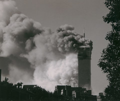
Engineering and the collapse of the WTC
From a National Geographic article comes an explanation of the nature of the destruction of the World Trade Center towers. Did you know that a bomber had crashed into an upper section of the Empire State Building during WWII?
Mississippi River as well as NYC on Thurs open notes quiz
Reading comprehension quiz on recent posts: need a couple of sample questions?
1. Constructions called __ aided shipping and helped create dry land from swamp in early New Orleans. a) canals b) bridges c) barges
d) locks.
2. The deposit of sediment by the Mississippi River, which keeps the land healthy via distribution of alluvial soil, was altered by the construction of __. a) canals b) bridges c) levees d) dams.
3. Once thought of as signs of marvelous, money-making activity, these constructions allow men to reach oil and gas wells. Sadly, they also contribute to widespread erosion of the wetlands. a) canals b) levees c) dams d) estuaries.
Mr T's procedure went well
It would seem that my medical procedure, undertaken at Schumpert under the scalpel of Kevin Marler, MD, has gone well. My mobility is limited for a few days but I feel optimistic about the big picture.
Will be home this week but will be thinking of you and (*hearts,* *flowers*) writing to you. Also grading recent Coastline papers and Indie work.
The above fabulous guitar, a Hendrix model Strat, belongs to musician and long-time friend Danny Wilder. In which of our 3 cities would the Stratocaster have been designed and produced?
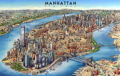
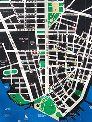
Practice for NYC map quiz to be taken Wed
Youse guys! Be ready to sketch a quick map of Manhattan and its neighbors on Wed.
- Include a dozen labels, correctly placed and spelled.
- You'll earn 15 pts.
- Write legibly.
- Title it with verve.
"Youse guys" is a phrase associated with a writer named Damon Runyon, who wrote comically of the ill-educated gangsters so often in the news in the 1920's. In fact, the name Nathan Detroit came from Runyon's reportage.
Here are a few NYC identifications for the quiz bowl on Fri:
- New Amsterdam
- Henry Hudson
- Peter Stuyvesant
-Algonquians
- Erie Canal, 1825
- Flatiron Building, 1902
- Subway construction began in 1900
Sunday, September 21, 2008
NYC, Los Angeles, Chicago: Week of Set 22 - 26
NYC, Los Angeles, Chicago:
Week of Set 22 - 26
Substitute is Mrs. Hanson, a terrific writer and kick boxer.
Mon and Tues classes are in the B-3 computer lab. Research into America’s 3 great cities in preparation for a team Quiz Bowl on Fri in which the winning group wins bonus points or a Lexus (one auto only and subject to all taxes, I’m afraid). Take the bonus points, please. Heck, for the price of a Lexus we might be able to get, like, 4 Smart Cars. I’ll look into it.
Your task:
Make a list of identifications on each city comprising the following topics -
- demographics
- history
- geography
- neighborhoods, regions, etc.
- climate
- notable buildings
- culture, including performing arts
- tourism
- cuisine
- sports
- personalities
- economy
- colleges
- transportation
- Use Worldbookonline.com, wikipedia.org or answers.com.
- Assemble all research items in bulleted form. Include sources at bottom. Have a print-out ready in class on Fri .
- Tie-breaker questions will be on Washington, DC.
Wed.
Hand-sketched map of NYC including your choice of 12 locations. Identifications must be placed spearedly and spelled mahootily.
Thurs.
Open notes reading comprehension quiz, multiple-choice, on class notes through Wed.
Fri.
Urban Quiz Bowl.
Friday, September 19, 2008
US map review . . .
US map review from work in the textbook:
1. NYC is about twice as populous as Washington, DC.
T / F
2. The principal population centers of the US are in the
a) Upper Mid West b) Deep South c) Northeast
d) Northwest
3. Vancouver and Seattle lie upon the a) Pacific b) Lake Superior c) North Atlantic d) Lake Michigan.
4. Canada is pretty much shaped like an exploding guinea pig. T / F
5. The most centrally-located of the big cities of the US:
a) Denver b) NYC c) Memphis d) Minneapolis.
6. Based upon the elevation map, Shreveport’s elevation must be approximately 1000 ft. T / F
7. Larger in area: a) Rocky Mts. b) Appalachian Mts. c) Mississippi Basin d) Great Plains.
8. Population density seems greater on the Pacific coast than on the Atlantic coast. T / F
9. Louisiana finds itself most definitely in the __ climate type. a) Mediterranean b) Tropical wet & dry
c) Humid continental d) Humid subtropical.
1. false / It's about 3 times bigger.
2. C
3. a
4. true
5. a
6. false / Shreveport's about 300 feet above sea level.
7. a
8. false
9. d / Humid subtropical.
The Mediterranean climate is considered the world's most generally-appealing climate. People will pay more and work more competitively to live in the sunny, dry, moderate Med climate. Example: San Diego and Southern California.
Megalopolis: word for a mega-city
In the US, one megalopolis comprises Boston-NYC-Philadelphia-Baltimore-Washington, DC. It's almost a continuous city as you go from one to the next.
Greetings from New York, the Empire State
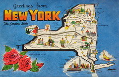
Instead of sketching a map of Manhattan and neighbors, the class sketched the state of New York, known as the Empire State.
Included:
Lake Erie
Lake Ontario
St Lawrence Seaway
Canada
Erie Canal
Hudson R.
Atlantic
Connecticut
New Jersey
Pennsylvania
Long Is.
Albany
The economic power of NYC is based largely on the port of NY. With this map you will see an additional factor in New York's economic development.
It concerns a gamble and investment made by NY in the 1800's: it is the Erie Canal. If you connect the Hudson River to the Erie Canal, which connects to the Great lakes and the resources of upper middle America - along all the Great Lakes - you have a gigantic economic development.
Speaking of rivers: what evidence have we seen that shows the Red River to be an economic force?
- Pratt Industries / paper recycling
- La Boardwalk
- casino gambling boats
Barbara Meyers invites you to a Freshman Parent Coffee on Th, Oct 2, 8:30 - 10:30 am
"Drop in and meet other parents," says the Invitation from Baraba Meyers, mother of 2 students at Cmhs, Jay and Mary. "Learn more about exciting freshman activities you don't want your kids to miss!"
Meyers produced the successful Speed Meet for first year students this month.
Location: 660 Elmwood.
Meyers produced the successful Speed Meet for first year students this month.
Location: 660 Elmwood.
Thursday, September 18, 2008
Sketch map of NYC: quiz on Wed.
Sketch and label the map of NYC as done in class.
On the quiz, label 12 items and, spelled correctly and put in the right locations, you will earn 15 pts.
Connecticut
New Jersey
Hudson R.
Atlantic
Long Is.
Man hat tan Is.
Staten Is.
Bronx
Queens
Brooklyn
Harlem
Central park
Site of the World Trade Center
Wall St. financial district
Coney Island
LaGuardia Airport
Kennedy International Airport (JFK)
Notes on the loss of the coastal lands in Southeast La.
Louisiana Coastline quiz next Thursday.
- Notes from Times-Picayune interactive graphic:
1. New Orleans (NO) area called Southeast La.
2. Region was created by Miss. R.
3. Geological history: the dynamic river changes course and changes the land.
Ex. in Red River: change in position of pivot in downtown railroad bridge.
4. Most current maps do not tell the truth about loss of coastal land. Based on 1930’s coastline.
5. End of an ice age some 4000 years ago: melting glaciers caused seas to rise. Gulf waters covered La., including Spt.
6. Region from Spt south to coast is called Gulf Coastal Plain. Essentially flat land.
7. Miss. delta land below NO is the product of the Miss. R.
sediment.
8. Miss. water is rich in nutrients. Its sediment, alluvial soil, maximizes crop growth. If the Miss. flow is cut off, the land is lost.
9. NO established in 1718. Spt est. in 1835.
10. Levee from Frennch “lever,” to rise.
11. Levees protected NO from flooding. Canals aided shipping and helped create dry land from swamp.
12. Levees cut off the deposit of sediment - sediment keeps the land healthy. Jetties keep rivers navigable by preventing erosion, but also stop the natural deposit of sediment.
13. Coastal canals were dredged so men could drill oil and gas wells. They are part of the erosion of the coast.
14. Subsidence, sinking land, is affecting the La. coast.
Other locations affected by subsidence: Venice, Italy, also California, Florida, Texas, other places in La.
15. Saltwater intrusion kills marsh plants and promotes erosion. It is caused by subsidence and canals.
16. Invasive species: nutria. This rodent eats marsh vegetation, enhancing erosion.
17. Sea level is rising worldwide, in part due to global warming. La flooding will grow in severity along with sea level rise.
18. Geologists predict severe land loss ahead. NO will be surrounded by seawater.
19. Solutions will costs trillions. Congress has thus far declined to pay the full bill.
20. Louisiana’s small population and lack of economic power mean that Congress will ignore our requests.
21. Will Congress increase its aid because of the national importance of the seafood and oil industries?
Wednesday, September 17, 2008
Attribution and documentation, a way of life
Attribution means giving credit where it's due and documentation means giving proof of your statement. Both represent a way of life for the educated class.
When you write a paper and offer your source, you are offering attribution or documenting your work. You may also do it in your presentations and discussions. Not "I heard it through the grapevine," but "I heard it on CBS news."
"I heard it on NPR, National Public Radio."
"According to the textbook, World Geography!"
"World Book is my source."
"Says so at Wikipedia.org."
"According to Mr. Trudeau, my geography teacher."
"Or so says the mayor, Cedric Glover."
Try to avoid this one: "I heard it on SpongeBob Squarepants."
But I'll accept "According to Homer Simpson," because the author, Matt Groening, is so well educated.
"Wall St. meltdown . . . "
Wed / Brief essay . . .
- What world of activity is implied by the term "Wall St."?
- Where is Wall St. located?
- Add a tight title.
Make a sketch map of NYC. Include . . .
Connecticut
New Jersey
Hudson R.
Atlantic
Long Is.
Man hat tan Is.
Staten Is.
Bronx
Queens
Brooklyn
George Washington: NYC or not?
Yes. The first president was inaugurated in NYC.
Tuesday, September 16, 2008
When attaching a piece of work in an email to your teacher: use Word doc.
Since I use Macs, you have to be acreful about the format in which you send me your work. One format that always works is Microsoft Word. Send anything and everything in a Word doc., please.
Center of the current financial crisis: Wall St, Lower Manhattan
The severe financial crisis being worked on in NYC this month is being watched by social studies students. Is another Great Depression looming?
With this in mind, we've sketched a map of NYC. On it are the following . . .
1. Man hat tan Island
2. Long Island
3. Brooklyn, Queens
4. Bronx
5. Staten Island
6. New Jersey
7. Hudson River
8. Atlantic
9. Wall St Financial District (NY Stock Exchange, site of the WTC)
With this in mind, we've sketched a map of NYC. On it are the following . . .
1. Man hat tan Island
2. Long Island
3. Brooklyn, Queens
4. Bronx
5. Staten Island
6. New Jersey
7. Hudson River
8. Atlantic
9. Wall St Financial District (NY Stock Exchange, site of the WTC)
Parent signature required on Africa to Louisiana essay
Parents: the most important indicator to me of your child's academic future will lie in the essay being returned to students this week. Written expression is a tough test of a student's competence.
Overall, I can make an optimistic report. Your children have been taught construction, logic, grammar and spelling. Yay! It is a privilege to work with such capable teens.
Please sign the essay; getting your signature is an assignment for your student.
The point sheet, on the other hand, does not have to be signed.
Late papers will lose a point unless there's an extenuating circumstance. I'll accept your note of explanation when necessary. But problems with printers can be surmounted by simply emailing me the assignment.
Monday, September 15, 2008
Mon, Sept 15: the week's schedule
Mon.
- Unit on US and Canada / see below.
Tues
- Progress report point sheets.
- Quiz on US / Canada as per notes taken on Mon.
- Hand in La. Coastline paper as constructed in lab on Fri.
Wed.
- US geo overview.
Thurs.
Back to School Night, 6 - 8 pm.
Parents must know their student homeroom class so as to pick up student schedule.
Fri.
US geo: intro to NYC.
Unit 2: the US and Canada / Trudeau / Mon, 9 / 15
Students will skim / read pp. 114 - 123 in textbook World Geography.
Students will work solo for approx. 35 mins and in groups (as in past) for 10 mins. Return desks to standard in last mins.
Activity 1 -
- Sketch, label and color (rims only) the US/Canada map, p. 115.
- Add to this map the major cities and populations as cited on p. 114. With accents of color. Titling.
- Chart study #4: what generalities can you make about the location of these population centers? Answer in notebook, on map.
Activity # 2 -
- Sketch & color & label the Physical map, p. 117.
- Add terminology from p. 116. Answer brief questions at end of each para. on p. 116.
Activity # 3 -
- Sketch demographic map, p. 119.
- Using color, label the greatest population centers.
Activity 4 -
- Sketch, label and color the rim of Climate and vegetation map, p. 120.
Activity 5 -
- Sketch, label add symbols to the Economic and Resource map, p. 122.
- Use color and symbols to designate the symbols on the US map.
Quiz Tues. on this material (some 9 questions). You may use these notes and sketch maps but Not your textbook. Typical questions? Like those found on p. 123 and at the end of each section.
Sunday, September 14, 2008
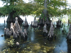
Cypress marsh: a disappearing part of the coast of Louisiana
New Orleans' daily, the Times-Picayune, remains a great newspaper, imho. Here's an example from their multi-media department:
The Rise and Disappearance of Southest Louisiana.
Please click and follow.
The Rise and Disappearance of Southest Louisiana.
Please click and follow.
Friday, September 12, 2008
Back to Skool Dance Fri, Sept 12, 6 to 9 pm
The Back to Skool Dance is always fun. Magnet doesn't have That many dances, so I'd recommend you jump on this one.
Each student can bring one guest who attends another school, says Mr Gallant.
Parents, please pick up your passengers no later than 9 pm. Those of us who chaperone really appreciate your punctuality.
Each student can bring one guest who attends another school, says Mr Gallant.
Parents, please pick up your passengers no later than 9 pm. Those of us who chaperone really appreciate your punctuality.
Indie work: comparing Mark Zuckerberg to Christopher Columbus
Mark Zuckerberg is the man of the moment because of his immensely successful site, Facebook. Christopher Columbus is notable for his brave exploration of new physical lands.
Despite some profound differences, they are quite comparable. Remember to search the Essay Guidelines to make sure your comparison essay gets the maximum points.
You may email your completed essay to trudeau@earthlink.net

Despite some profound differences, they are quite comparable. Remember to search the Essay Guidelines to make sure your comparison essay gets the maximum points.
You may email your completed essay to trudeau@earthlink.net
A brief report on the problems facing the Louisiana coastline
Students visit the Computer lab in B-3 today to assemble a brief report on the loss of coastline that is such a problem for the Bayou State.
The report -
- due Tuesday
- typed.
- one page.
- edited (bulleted) reasons for loss of coastal land.
- sources (at bottom or in the body of the paper)
- snarly title, explanatory subtitle.
- map indicating problems along the coastline.
Email it home so as to complete and print the report.
The report -
- due Tuesday
- typed.
- one page.
- edited (bulleted) reasons for loss of coastal land.
- sources (at bottom or in the body of the paper)
- snarly title, explanatory subtitle.
- map indicating problems along the coastline.
Email it home so as to complete and print the report.
Thursday, September 11, 2008
Remembering 9-11
While I encourage my students and parents to read the background of the 9/11 attack at worldbookonline.com or wikipedia.org, there are a couple of facts that I'd like to emphasize.
Osama bin Laden and most of the assassins were natives of Saudi Arabia. The average American probably thinks they were Afghani because many members of al Qaeda were trained in Afghanistan.
"Then why didn't we attack Saudi Arabia?"
We have an uneasy relationship with Saudi Arabia. The overriding fact is that we need their oil. The fact that al Qaeda got most of its money and philosophical support from Saudi Arabians was an inconvenient truth in the post-9/11 war on terrorism.
"Then why did we attack Iraq?" In my opinion, there's no satisfactory answer to that one aside from faulty intelligence and questionable judgement.
Homework in geography class?
The basic and quotidian assignment is not one that my students are accustomed to:
Read the class web site.
Each day I post notes and assignments. It's like a constantly evolving personal textbook. If you keep up with the flow of material it all makes sense. If you print it out and try to read it once a week it can seem incomprehensible.
Reading your class notes on a web site is a skill for now and for the future. More and more teachers will be posting their class marterial on similar sites.
Fri, Sept 12 brings a different sort of homework: a typed essay. Many of my students checked their drafts with me today. Yay. That's the mark of an outstanding worker.
Wednesday, September 10, 2008
The Caribs: among the first to be enslaved, tortured and genocidally murdered in the New World
Carib, Island Carib or Kalinago people, after whom the Caribbean Sea was named, live in the Lesser Antilles islands, says Wikipedia.
They were among the first people to be enslaved, tortured and genocidally murdered by the Spanish in the New World.
The Caribs were skilled boatbuilders and sailors, and seem to have owed their dominance in the Caribbean basin to their mastery of the arts of war.
The Caribs were themselves displaced by the Europeans, and most were eventually exterminated or assimilated during the colonial period by the Spanish.
Even after Columbus was presented with evidence that the cannibalism of the indigenous people was a myth, the myth was perpetuated because in 1503, Queen Isabella ruled that only people who were better off under slavery (including cannibals) could legally be taken as slaves. This provided Spaniards an incentive and legalistic pretext for identifying various Amerindian groups as cannibals in order to enslave them and take their lands away from them.
Archipelago: a chain of islands, such as the West Indies or Hawaii
Southeastern (windward) Islands - Hawaiian Archipelago - Ka Pae `Aina O Hawai`i Nei
Originally uploaded by brewbooks
In the Caribbean archipelago, there is an island that comprises two nations, Haiti and the Dominican Republic. Finding the name of that island is not easy. It is known as Hispaniola.
What is the implication carried by the name Hispaniola? The indication is it's connected to Spain or something Hispanic. That's correct. It was named by Columbus for his beloved nation of Spain, or Espana.
Caribs: the native people of Hispaniola and the West Indies
The word "hurricane" derives from the Carib god of evil, Hurican. It is used for severe storms in the North Atlantic and the North Pacific east of the international dateline.
- BusnessNet.com

- BusnessNet.com
Tuesday, September 09, 2008
Parents & students: get a copy of the Rand McNally Quick Reference World Atlas so that each day's class work in enhanced
Please help me by making sure that students have
a) the Rand McNally Quick Reference World Atlas ($6)
b) have paid the class fee of $5 - payable to Caddo Magnet High School.
The deadline is Friday. I appreciate your help.

a) the Rand McNally Quick Reference World Atlas ($6)
b) have paid the class fee of $5 - payable to Caddo Magnet High School.
The deadline is Friday. I appreciate your help.
Riding as storm from the coast of Africa to the shores of Louisiana; brief essay due Fri, Sept 12
Brief essay:
Riding a storm from Africa to Louisiana
5 pt essay due Fri, Sept 12
To be scored on -
- English construction.
- Orderly flow of locations.
- Completeness.
- Must be typed.
- Name, date, hour in upper right corner, please.
Please include -
- 2 ocean currents
- 1 ocean and 2 seas
- 3 islands
- 2 continents
- 1 peninsula
- 3 states
- punchy title and explanatory subtitle.
Monday, September 08, 2008
Speaking of Mexican resorts: Acapulco is on the cliffs of the Pacific
Cliff divers are a signature tourist-based activity of the boys of Acapulco, Mexico's longest-running beach resort.
Acapulco's success was duplicated by a Yucatan resort developed decades later, Cancun.

Acapulco's success was duplicated by a Yucatan resort developed decades later, Cancun.
Jacques Cousteau: 20th century undersea exlorer, inventor and author
Jacques-Yves Cousteau (1910 – 1997) was a French naval officer, explorer, ecologist, filmmaker, scientist, photographer, author and researcher who studied the sea and all forms of life in water.
He co-developed the aqua-lung, or SCUBA gear, and pioneered marine conservation, says Wikipedia.org.
He explored the world's seas in his research ship, the Calypso. He made films about the seas and fishes that were aired by National Geographic.
One of the many places he popularized - for its underwater beauty - was Isla Cozumel, Mexico.
Sunday, September 07, 2008
Two tests this week in geography: map and open notes
Tues, Sept 9 -
Mississippi Valley map
- path of the Miss. R.
- hand-sketched states in approximate blocks
- 10 states, correctly placed and spelled
- 3 cities, " "
14 pts.
(additional rivers will be omitted this week)
Thurs, Sept 11 -
Open notes, multiple choice quiz based on class and web site notes and emphasizing reading comprehension.
approx. 15 pts.
Indie work:
Read, research and compare in a typed essay -
* Louisiana and Alaska
* New Orleans and Chicago
Planning a cross-country trip and using your atlas
Practical geography and basic use of maps:
Planning a trip by making an outline of the cities and terrain to be encountered in a series of cross-country treks.
From your home base of New Orleans you will be traveling by motorized, wheeled vehicle - using vessels and other conveyances when absolutely unavoidable - to ___, ___ .
1) You must list the cities through which you believe your trip will be best taken.
2) Using clues from the atlas, you must describe the general terrain to be enjoyed during the major sections of the trip.
3) Using the atlas scale, you must estimate the approximate length of the journey in the Old English measurement of “miles.”
4) You must make an approximate sketch of the US map, including the cities relevant to your peregrination.
5) One person in your group must report the pertinent facts to the class as the group follows the route in their atlas.
Destinations -
1) NYC
2) Detroit
3) Minneapolis / St Paul
4) Helena, Montana
5) Seattle
6) Los Angeles
7) Acapulco, Mexico
8) Nassau, the Bahamas
Saturday, September 06, 2008
The art of editing the material you read
Editing is a higher thinking skill.
In a class activity involving a series of review questions, the business of editing - compressing - the questions is probably a higher skill activity than the finding of the answer.
It entails:
- Deciding quickly which words are the essence of the question.
- Which words to omit.
- Use of abbreviations.
- A possible re-ordering of the words to shorten the statement.
When first-year students take notes, the mental sweat spritzes the room.
Answers to Quiz # 1, "Latitude"
You'll find the questions to quiz #1 when you scroll farther down.
1. A) Great Circle
2. T
3. C) Ni Hau
4. T
5. T
6. C) Beijing, China
7. B) Prime Meridian
8. A) Western
9. F
10. T
11. A) Louisiana
12. D) 32N, 94W
13. T
14. A) Paper
15. D) Red River
B) 150
16. D) Los Angeles
17. C) Mexico City
18. B) Hong Kong, China
19. C) 35S, 59W
20. A) 6S, 106E

1. A) Great Circle
2. T
3. C) Ni Hau
4. T
5. T
6. C) Beijing, China
7. B) Prime Meridian
8. A) Western
9. F
10. T
11. A) Louisiana
12. D) 32N, 94W
13. T
14. A) Paper
15. D) Red River
B) 150
16. D) Los Angeles
17. C) Mexico City
18. B) Hong Kong, China
19. C) 35S, 59W
20. A) 6S, 106E
Friday, September 05, 2008
Africa to Louisiana project
Friday's review:
1. Name the ocean current that flows south along the coast of West Africa.
2. “ “ “ that flows west across the Atlantic and into the Caribbean at the midsection of the earth.
3. The Yucatan peninsula is a region. To what nation does it belong?
4. The capital of Cuba is a city on a beautiful and protective harbor. a) Name the city. b) State the English word which indicates a shelter from the storm.
5. Which body of water would be the most effective haven for ship-borne colonialists looking for shelter from storms? a) mouth of the Mississippi River b) Mobile Bay c) Galveston Island.
6. Name for a bay in which the fresh water meets the salt water and wildlife and fish life is incubated: __ .
7. Type of rich soil that is deposited in a river delta each time the river floods: __ .
8. Storms often approach the Gulf of Mexico from the Caribbean. When the come from the south they pass through a strait bordered by Cuba and __ __ .
9. Name the island that lies south of Cuba and west of haiti / Dominican Republic: __ .
10. Explain in brief - but with logic steps - how the weather in Africa can affect the state of Louisiana.
Thursday, September 04, 2008
Storm map: how weather gets from the West African coast to the Gulf of Mexico
Th, Sept 4
Storm map project:
Sketch, label and color -
- Fla
- Al
- Ms
- La
- Tx
- Mexico
- Yucatan Peninsula
- Cuba
- Haiti / Dominican Republic (Santo Domingo is the capital city).
- Gulf of Mexico
- Caribbean
From the Ocean Currents map (see earlier post) -
- Canary Current
- Equatorial Current
The lesson: "Recognizing connections over vast distances - such as linking Africa and Louisiana via weather - enables students to understand global dynamics. Think big."
questions found on the first geography quiz, entitled Latitude
Geography quiz: the Basics / 08-09 / Trudeau
1. A jet transport plane is likely to traverse a __ route as it goes on a transoceanic journey. a) Great Circle b) True Direction c) shipping d) Gulf stream.
2. The Mercator map is a cylindrical projection created about 1569 CE. T / F
3. Chinese greeting: a) Salaam alaykum b) Shalom
c) Ni hau d) S’up.
4. On the East the Mississippi River is adjacent to Louisiana, Mississippi, Tennessee and Minnesota. T / F
5. The Missouri River is longer than the Mississippi. T / F
6. What city lies at 39N, 116E?
a) Seoul, S. Korea b) Shanghai, China c) Beijing, China
d) Denver, Co
7. Greenwich, England, is home to the a) equator b) prime meridian c) prime rib, au jus.
8. Canada would be considered part of the __ hemisphere. a) Western b) Eastern c) Southern d) Central.
9. The Prime Meridian runs through London and the Equator runs through Hong Kong. T / F
10. The Tropic of Capricorn crosses South America, Africa, Madagascar and Australia. T / F
11. 90W is a line of longitude that runs through
a) Louisiana b) India and Bangladesh.
12. Latitude and longitude of Shreveport: a) 32N, 94E
b) 32E, 94N c) 32S, 94N d) 32N, 94W.
13. The implication in the article on corn is that rising costs of gasoline will not affect the corn crop. T / F
14. Pratt Industries is the company behind Shreveport’s new recycling program. Their main business is recycling
a) paper b) wood c) plastics d) glass products.
15. Shreveport’s recycling company, Pratt Industries, has
built its center on a site advantageous for cheap transportation. It is located on ____. a) I-49 b) I-20 c) downtown d) Red River.
15. Henry Miller Shreve took on quite a project when he began - in 1832 - to clear the log jam from the Red River. The Great Raft in the Red spanned about __ miles. a) 50 b) 150 c) 1,500 d) 10, 500.
Match a famous city with each of these coordinates:
16. 34N, 118W a) Boston b) Manila, Philippines c) Madrid, Spain d) Los Angeles
17. 19N, 99W a) Rio de Janeiro, Brazil b) Mecca, Saudi Arabia c) Mexico City
18. 22N, 115E a) Beijing, China b) Hong Kong, China c) Sydney, Australia
Supply the coordinates for -
19. Buenos Aires, Argentina a) 35N, 59E b) 35S, 59E c) 35S, 59W
20. Jakarta, Indonesia a) 6S, 106E b) 6N, 106E c) 6S, 106W d) 6E, 106S
Answers to be posted tomorrow.
Wednesday, September 03, 2008
WorldBookOnline.com is a resource you can use from home or school
Please go to Worldbookonline.com to enjoy a terrific resource. It is a service paid for by the state so that we may all have a solid reference work no matter where we are studying.
There's a new home access for students and teachers, says WB representative and Cmhs parent Andy Snelling:.
www.worldbookonline.com
ID- lahome
Password- student
Worldbookonline.com is almost a one-stop resource center. You'll be gratified to see all the ways it can be helpful in your school work.

There's a new home access for students and teachers, says WB representative and Cmhs parent Andy Snelling:.
www.worldbookonline.com
ID- lahome
Password- student
Worldbookonline.com is almost a one-stop resource center. You'll be gratified to see all the ways it can be helpful in your school work.
Project: relief Map of Cmhs
How to make a simple topograhical map of the Cmhs campus?
A relief map. Elevation map.
Start with a sketch of the wing placement.
Add paper representations of the buildings.
Find a way to show the general elevation of the land on which most of the wings are built.

A relief map. Elevation map.
Start with a sketch of the wing placement.
Add paper representations of the buildings.
Find a way to show the general elevation of the land on which most of the wings are built.
Weather permitting: making a map of CMHS aided by a walking field trip
Mental and physical mapping is a priority for geography students. Thus we must, weather permitting, venture out of the classroom to make a map of our educational site.
We will combine perspectives and move beyond the technical view (while using the official view, to be sure) to create artful renditions of the campus.
We will combine perspectives and move beyond the technical view (while using the official view, to be sure) to create artful renditions of the campus.
Subscribe to:
Posts (Atom)
