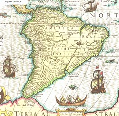
Mapa antiguo de América del Sur; old South America map.
Originally uploaded by thejourney1972 (offline for some days)
What you ought to know:
1. Atlantic & Pacific (A & P)
2. Panama, Central Am.
3. Colombia
4. Venezuela
5. Ecuador
6. Peru
7. Brazil (Brasil)
8. Amazon R.
9. Andes Mts.
10. Chile
11. Argentina
12. Buenos Aires, Argentina
13. Sao Paulo, Brazil
14. Rio de Janeiro, Br.
15. Caribbean Sea
16. Cape Horn / Tierra del Fuego
17. Drake Passage or Strait of Magellan
Cape Horn is widely considered to be the most southerly point of South America, and marks the northern boundary of the Drake Passage; for many years it was a major milestone on the clipper route, by which sailing ships carried trade around the world. However, the waters around the cape are particularly hazardous, owing to strong winds, large waves, strong currents and icebergs; these dangers have made it notorious as a sailors' graveyard, says Wikipedia.
The need for ships to round the Cape Horn was greatly reduced by the opening of the Panama Canal in 1914. However, sailing around the Horn is widely regarded as one of the major challenges in yachting.
