Jan 28,29, Feb 1
Geography classes
Hours: 1, 3, 5, 6
Unit
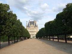
Comparing the Great European Cities / Paris, London, Rome and Berlin
1. Research info and images.
2. Edit, identify appropriate material.
3. Assemble presentations.
4. Share work on Google Docs.
Each team of students takes a city and sub-divides into
- Demographics (pop, literacy, PCI, ethnicity, etc) - 3 images
- History (major conquerors, major periods, those famous in
technology, arts, business) 4 images
- Contemporary connections (trading partners, technology,
relationships w neighbors, languages, products & brand names, etc)
3 images
At the end of 3 research & assembly sessions, students will have
produced packages containing -
- minimum of 10 slides / images
- bulleted explanations (brief, edited material) on each slide (about 3 info bullets per image)
- images that are clear and large when projected
- spelling, grammar
- On additional slides: quiz for classmates / 7 multiple-choice general, simple questions.
- Map quiz items from the city and nation (Ex: Atlantic Ocean, Alps Mtns.) for class quiz. At east 7 items, 7 images.
Presentations will take place in the classroom.
skip to main |
skip to sidebar
For students and parents who love education and exploration of the social sciences . . .
Search This Blog
Followers
Blog Archive
-
▼
2010
(346)
-
▼
January
(44)
- There is now abundant scientific evidence that hum...
- Americans' electricity comes from Coal, which also...
- Euro cities: Paris, Roma, London, Berlin
- Climate change / PBS.org / Frontline
- The Sunshine State: basic background on Florida's map
- Miami: America's 4th population center
- America's 4th center of population: Miami
- Amadeus review quiz
- Upfront magazine 01.18.10 - Climate change
- Indie essays
- Geography classes in lbraray next Thurs-Fri-Mon on...
- Geography class test-taking guidelines
- Requiescat in pace: Taco Bell founder Glen W Bell
- Vienna, one of the world's most liveable cities
- Guten tag!
- Guten abend! Basic phrases from the Deutsch
- Amadeus: quotes and questions
- A review of details from the movie Amadeus
- Magnet's school web site has been updated: Caddoma...
- Mozart was home-schooled and schooled on the road ...
- Mozart desired a composer's position in Vienna, ci...
- Italian composer Antonio Salieri - did he hate Moz...
- Mozart's Turkish opera: Abduction from the Seraglio
- Effervesce: geography vocab
- Vermeer painting: Young Woman Seated at a Harpsichord
- Sketch and label the neighbors of Austria
- The difference between Western Europe and Eastern ...
- Wolfgang Amadeus Mozart, 1756 - 1791, Vienna, Austria
- Semester exam: notes, old quizzes, essay background
- Vancouver to Quebec, a Canada quiz & answers
- Exam bonus points comparison essay: how to score 1...
- The Yucatan to Venezuela / the Caribbean quiz / an...
- The Greater and Lesser Antilles / quiz & answers
- Brazil, land of futbol / quiz & answers
- Tallest Building On Earth opens: Burj Dubai rename...
- Geography open notes quiz on Sept 10; call it Tres...
- Lawrence of Arabia study guide answers, numbers 62...
- A wee quiz on 3 ginormous cities & the answers
- It's the Hard-knock Life - For Us quiz & answers
- Three cacophonous cities & answers / geography quiz 5
- Water, Water, Everywhere quiz & answers / Sept 3
- Semester exam: Canada quiz answers
- Fun, fun, fun: Semester exam materials
- Semester review: the Mexico / Tenochtitlan quiz
-
▼
January
(44)

