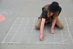
Ancient advances in mapping seen in Babylonia, Mesopotamia, about 2,300 BCE (Before the Common Era). Use of geometry in mapping.
Egyptians use geometry in mapping for land ownership.
Greece: Strabo wrote the book Geographia about 63 BCE.
* Pythagoras was the first to offer proof that the earth is spherical.
* Greeks develop map projections and the grid system.
Cradles of Civilization, acc to A History of the World:
* Mesopotamia
* Nile Valley
* China's Huang valley
* Indus Valley of Pakistan / India.
1) Storms seem larger than usual in recent years. According to National Geographic, scientists largely attribute this to a) coastal erosion b) loss of barrier islands c) changes in ocean currents such as the Gulf Stream d) global warming.
Name the large city closest to:
2) 40N, 74W
3) 32N, 35E
4) 30S, 20E
5) 35S, 150E
6) 30E, 90W
7) The region associated with the earliest use of math and mapping: a) Babylonia b) Mesopotamia c) Egypt d) Greece.
8) Greenwich, England, is home to the a) equator b) prime meridian c) oldest section of London.
9) Pythagoras and the grid system are associated with a) Greece b) Egypt c) Mesopotamia.
10) This ancient region was not mentioned in notes on the history of cartography, but it is one of the regions designated a Cradle of Civilization. We may guess that their achievements in map making were also significant.
a) China b) Rome, Italy c) Aztecs, Mexico City d) Constantinople.
11) Called the Father of geography for his book Geographia, this scholar was an ancient Greek: a) Plato b) Herodotus c) Pythagoras d) Aristotle.
12) Called the most ancient city of the Western world: a) Babylon b) Cairo
c) Alexandria d) Ur.
13) Write the grid coordinates for Istanbul (formerly Constantinople).
14) Sometimes the world fights over ethnocentric concerns (ie, the Germans wanted to take over most of Europe because they deserved it, said Hitler) and sometimes it simply accepts them.
In one or two sentences describe a situation in which the world has quietly accepted an ethnocentric term and describe the non-ethnocentric alternative to that term. (2 pts.)
Answers: geography / cartography
1. d global warming
2. 40N, 74W: NYC; that single answer should be adequate to get you started on latitude and longitude.
3. __
4. __
5. __
6. __
7. d Greece
8. b prime meridian
9. a Greece
10. a China
11. b Herodotus
12. d Ur
13. __N, __E
Thursday, August 21, 2008
Subscribe to:
Post Comments (Atom)


No comments:
Post a Comment