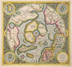
The Mercator projection is a cylindrical map projection presented by the Flemish geographer and cartographer Gerardus Mercator, in 1569, says Wikipedia.
It became the standard map projection for nautical purposes because of its ability to represent lines of constant true bearing or true course, known as rhumb lines, as straight line segments.
While the direction and shapes are accurate on a Mercator projection, it distorts size, in an increasing degree away from the equator.
Tuesday, August 26, 2008
Subscribe to:
Post Comments (Atom)


No comments:
Post a Comment